Basic Information
Course Location: Lake D'Arbonne State Park
Geographic Location: west of Farmerville, LA (32.78094, -92.49258)
Date Visited: February 2025
Number of Holes: 18
Course Length: 5906 feet, par 63
Cost to Play: $3 park entrance fee
Difficulty Level: recreational, high
Difficulty Level: recreational, high
Carts: not advisable due to steep and rough terrain
Potential to Lose Discs: medium due to dense woods
Park Information: https://www.lastateparks.com/parks-preserves/lake-darbonne-state-park
DG Course Review Page: https://www.dgcoursereview.com/courses/lake-darbonne-state-park.4138
UDisc Page: https://udisc.com/courses/lake-d-arbonne-ei1A
Course Walkabout Video, Front 9: (coming January 23, 2026)
Course Walkabout Video, Back 9: (coming January 30, 2026)
Driving Directions: From Farmerville, take SR 2 west 5.5 miles to Evergreen Road and turn left on Evergreen Rd. Drive Evergreen Rd. south 0.3 miles to the signed park entrance on the left. Turn left to enter the park, pay the entrance fee, and turn right at the first 2 park road intersections. Park in the parking lot in front of the group camp building. #1 tee is across the parking lot from the building; look for the trail sign below.
Course Constructions:
Tees: concrete, 1 per hole
Baskets: mach 3, 1 per hole
Signage: hole sign on each tee
Amenities: practice basket, group camp, 1 bench, other amenities elsewhere in the park
Summary Review: 2.5 Stars (out of 5)
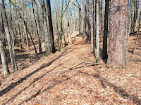
The disc golf course at Lake D'Arbonne State Park occupies a compact heavily wooded plot of land in the northwest corner of the park near the park entrance. While the terrain is not hilly by mountain standards, it has more elevation than you might expect for Louisiana. The course includes 3 holes that measure more than 400 feet, including 2 600-foot par 5's that are short and open enough to be par 4's. Other than those 3 holes, every hole is a heavily-wooded par 3 in the 250-300 foot range, give or take a few feet. Thus, a little more hole variety would be nice. Course signage and constructions are adequate to good. Fairways on many holes coincide with hiking trails, and in many areas the course seems to have been laid out to coincide with pre-existing hiking trails and power lines. While designing a course this way saves on construction labor, it doesn't make for the best disc golf, and it creates conflicts with walkers. I had no real trouble following the course route. Course maintenance was questionable on my visit: 1 basket was missing, a downed pine tree covered the 16th tee, and a thick layer of pine needles and leaf litter was everywhere, not to mention the underbrush. Nevertheless, the fallen pine tree still had green needles, so it hadn't been down for too long. Each hole has only 1 tee, 1 basket, and 1 possible basket position, which limits adaptability and re-playability. Overall, you could definitely lay out an elite-level course in this park, but what is here right now falls short of that mark. This is a decent course to play if you come to this park for other reasons such as to hike, fish, or camp.
Hole-by-Hole Review
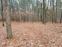
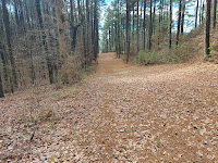
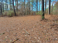
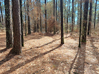
Distances taken from hole signs. Picture sequence for each hole is 1) tee, 2) approach, 3) basket to tee.
Hole #1: 318 feet, par 4
Comments: Welcome to the woods, where we will stay for the entire course. This fairway follows an orange-blazed hiking trail, and while it is tight the trail is wide enough to drive a golf cart down. More problematic are the 2 doglegs, first a moderate dogleg right then a slight dogleg left. To actually get a disc to stay in this fairway will be a real challenge. If you can get all the way around the first dogleg, you will have a chance at eagle. To get to #2 tee, walk behind the basket and turn right on the power line corridor.
Hole #2: 369 feet, par 4
Comments: The next 4 holes play southwest down a power line corridor. This hole is a slight dogleg right, and the basket is located 10 feet outside the power line corridor to the right. The line through the trees into the basket is tight, but as with the previous hole if you can get your tee shot far enough down the power line corridor, eagle is a possibility. Imagine an eagle-eagle start! #3 tee is further southwest down the power line corridor.
Hole #3: 620 feet, par 5
Comments: The basket on this hole is on the left edge of the power line corridor, so just keep throwing your disc as far down the corridor as you can. Straying from the power line corridor will probably require a recovery throw, but 2 very good throws could yield yet another eagle! #4 tee is further southwest down the power line corridor.
Hole #4: 320 feet, par 3
Comments: The eagle run almost surely ends here. This hole is similar to hole #2 but straighter with the basket not as far off of the power line corridor. #5 tee is further southwest down the power line corridor.
Hole #5: 606 feet, par 5
Comments: similar to hole #3 but more downhill. The basket was missing on this hole when I came here, so I used a stump under the power line as my "basket." #6 tee is back up the fairway and in the woods to the left.
Hole #6: 232 feet, par 3
Comments: now we go from the power line corridor back to the hiking trail, this time a trail marked with white blazes. The basket is located in a dense cluster of pine trees to the right of the trail, so you will need a left-to-right disc flight and a little luck to get near the basket in 1 throw. #7 tee is to the left.
Hole #7: 240 feet, par 3
Comments: a downhill sweeping dogleg left, there are lots of small trees near the basket. On the tee, I would focus on getting around the dogleg and hope I had a clear putt at birdie. This hole would be better with fewer trees. #8 tee is behind the basket and to the right.
Hole #8: 319 feet, par 4
Comments: a tight hole but with a well-defined fairway that plays down and up across a steep ravine. There is a steep drop-off to the left of the basket, so don't miss left on your approach. This would be my favorite hole on this course if it were a par 3. #9 tee is uphill to the right.
Hole #9: 278 feet, par 3
Comments: a fairly tight uphill hole, the basket is to the left of the cleared corridor in a tight corner surrounded by lots of small trees. As with hole #7, I would like this hole better with fewer trees. #10 tee is several hundred feet away; walk uphill to the lodge parking lot, start heading out the entrance road, and look to the right.
Hole #10: 273 feet, par 3
Comments: The next 5 holes play down and up the same hillside in spaghetti fashion. There are several hiking trails on this hillside, so you have to watch for walkers on all of these holes. This hole is a gradual dogleg left that plays steeply downhill. The basket is near the bottom of the ravine with a steep dropoff to the stream directly behind the basket; don't miss long! #11 tee is to the right.
Hole #11: 271 feet, par 3
Comments: This hole is straighter but plays steeply back uphill. A very slight left-to-right disc flight gives the best chance to get through the trees. #12 tee is to the left.
Hole #12: 312 feet, par 3
Comments: steeply back downhill we go on this dogleg right. The fairway is reasonably wide, but dense woods line either side of the fairway. Due to the dogleg, the fairway also has a right-to-left cross-slope, so keeping your disc in the fairway is a challenge. #13 tee is to the right.
Hole #13: 220 feet, par 3
Comments: you guessed it: straight back up the hill with the group lodge in the background. This hole is a slight dogleg left, and the fairway is rather wide for a heavily-wooded hole. Thus, if you can throw it accurate enough and far enough to get up the hill, a birdie opportunity should await. #14 tee is to the left.
Hole #14: 225 feet, par 3
Comments: back down into the ravine one more time. This hole is a slight dogleg right with the dogleg very close to the tee. Large pine trees line either side of the fairway, so you will need an oddly-shaped and accurate disc flight to get close to the basket in 1 throw. #15 tee is downhill and to the left.
Hole #15: 319 feet, par 4
Comments: a dogleg left that plays down and up across a ravine, this hole is similar to hole #8, but this ravine is more gradually sloped than the ravine on that hole. The fairway is reasonably tight, and a hiking trail bridge gets you over the stream at the bottom of the ravine. The gap between the trees in front of the basket is narrow, but because this hole is a par 4, birdie is still very achievable. #16 tee is behind the basket.
Hole #16: 256 feet, par 3
Comments: very straight, very tight, very uphill, rather uninspiring. #17 tee is a few hundred feet away. Walk uphill to the park road behind the basket and turn left. Where the park road forks, #17 tee is between the two forks.
Hole #17: 420 feet, par 4
Comments: the uphill climb continues to the highest point on the course. The fairway coincides with a wide two-track hiking trail that doglegs moderately left. The dogleg is almost 300 feet from the tee, so you might end up playing a couple of straight shots around the dogleg. Dense woods preclude cutting the dogleg. #18 tee is to the left.
Hole #18: 308 feet, par 3
Comments: Moderately downhill, this sharp dogleg left plays across a small stream twice. The fairway is somewhat tight, and there are plenty of large trees near the basket. Par is a good score on this challenging finishing hole. To get to the parking lot, walk to the road behind the basket and turn right.










No comments:
Post a Comment