Basic Information
Course Location: Community Park
Geographic Location: northeast of Milford, OH
Date Last Visited: October 2022
Number of Holes: 9
Course Length: 2105 feet, par 28
Cost to Play: free
Difficulty Level: recreational, low
Carts: should be fine here
Beginner Friendly? yes
Potential to Lose Discs: low/medium; some dense brush plus a creek
Park Information: https://www.miamitwpoh.gov/community.html
DG Course Review Page: https://www.dgcoursereview.com/course.php?id=4076
Udisc Page: https://udisc.com/courses/karl-von-coldewey-Jv8X
Course Walkabout Video:
Driving Directions: On the northeast side of Cincinnati, take I-275 to SR 28 (exit 57). Exit and go east on SR 28. Drive SR 28 east 2.4 miles to Buckwheat Road and turn right on Buckwheat Rd. The park entrance is 0.5 miles ahead on the right; park in the far back left corner of the parking lot. Hole #1 tee is located behind the picnic pavilion.

Course Constructions:
Tees: concrete, 1 per hole
Baskets: 1 per hole; some seemed to be bent or leaning on my visit
Signage: course map near picnic pavilion, hole sign on each tee
Amenities: picnic pavilion, a couple of benches, historic 1800's house
Summary Review: 2 Stars (out of 5)
The Karl von Coldewey Disc Golf Course at Leming Park offers a pleasant and straight-forward half-round that will leave most players wanting more. The course routing is flawless: there are no long walks from basket to next tee, and I had no trouble navigating the course without a course map. The course constructions are adequate, and I enjoyed the walk over and around a wide ravine. Some of the baskets are leaning, and I have read that mud can be an issue here after a good rain. The small creek at the bottom of this ravine does come into play on several holes, but water levels are usually low enough that a disc thrown into the creek can be retrieved. Unfortunately, many of the holes themselves are short and straightforward, offering little in the way of obstacles. Hole #9 is the one real exception: it is longer with a forced throw over the creek, but it is still very open. As a weak recreational player, I enjoyed this course, but it has little to offer experienced and skilled players except maybe putting practice. It is a nice unpretentious little course for beginners.
Hole-by-Hole Review
Distances taken from hole signs. Picture sequence for each hole is 1) tee, 2) approach, 3) basket to tee.
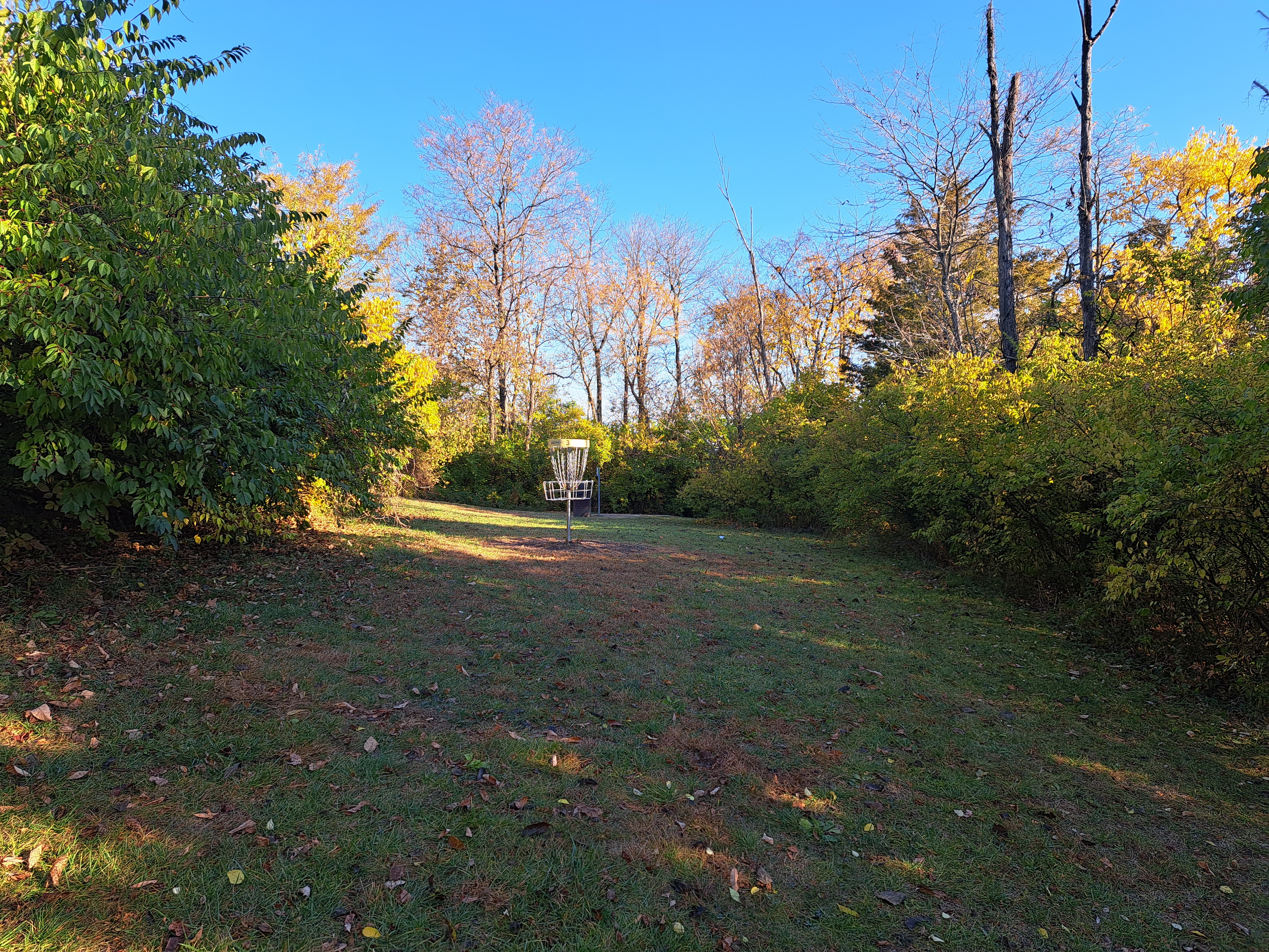
Hole #1: 210 feet, par 3


Comments: a nearly flat and completely open hole with only one small cluster of trees guarding the left side of the basket. There is a slight left-to-right cross slope, but a good first throw should create a birdie opportunity. #2 tee is behind the basket.
Hole #2: 195 feet, par 3


Comments: another completely open hole, but this hole plays significantly downhill. Thus, an ace is possible with a good and lucky throw: you can't see the basket while standing on the tee due to the hill. The basket is just left of a tall pine tree you can see on the opposite hillside. Dense woods stand within 20 feet of the basket on the right, left, and long, so there is a degree of risk if you are aggressive and go for the ace. Also, a concrete walking path crosses the fairway, so check for pedestrians before you throw. #3 tee is to the right.
Hole #3: 215 feet, par 3


Comments: a short hole that is also a sharp dogleg left. Dense woods guard the inside of the dogleg, and a creek sits about 20 feet behind the basket. There is plenty of room to the right, so you have to decide how much risk you care to take with your tee shot. #4 tee is to the right.
Hole #4: 195 feet, par 3


Comments: kind of the inverse of the previous hole, this hole is a sharp dogleg right with the creek limiting your room to the left. A large tree and a few smaller trees guard the inside of the dogleg. #5 tee is to the left beside the creek.
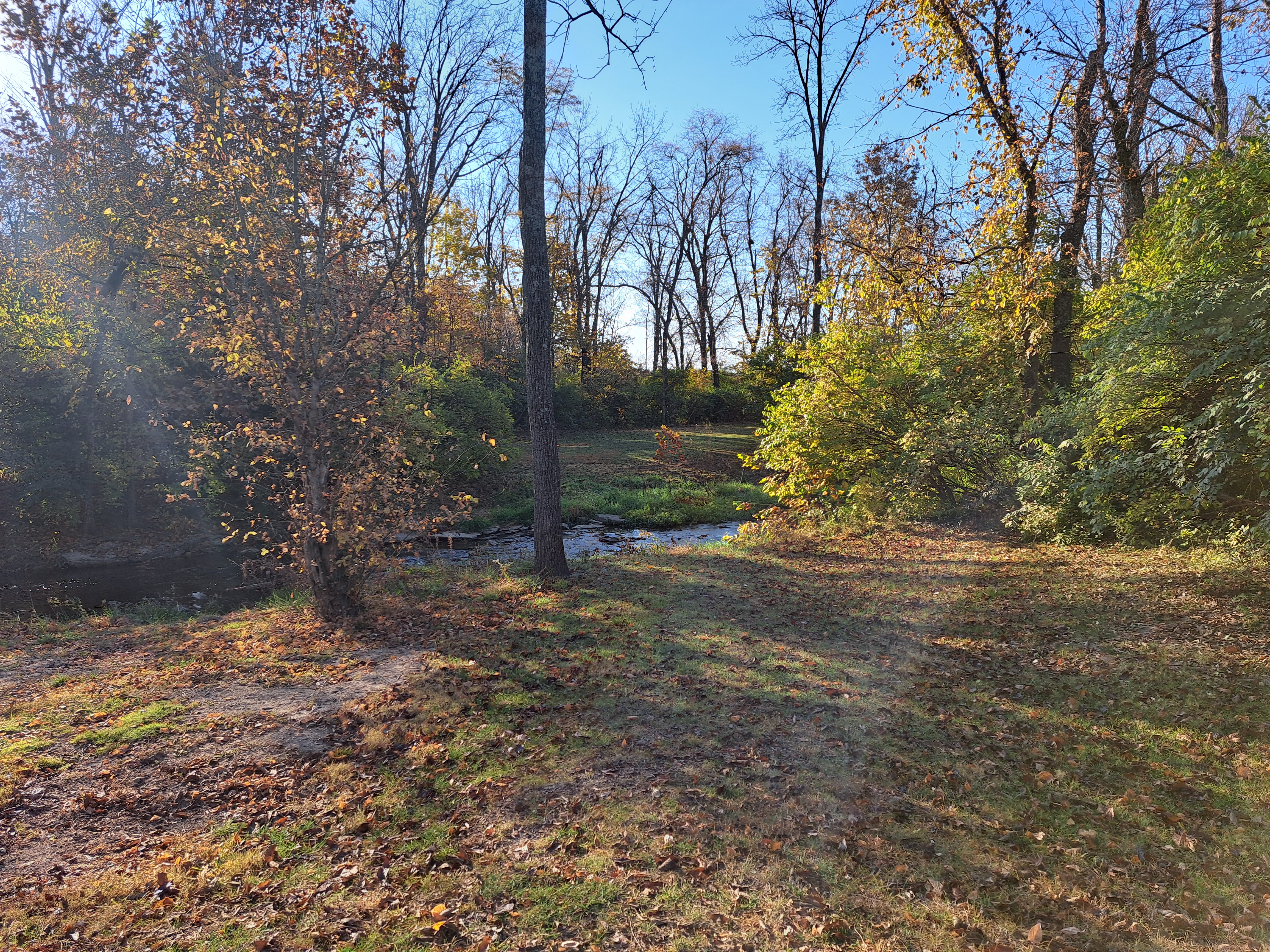
Hole #5: 325 feet, par 3


Comments: a forced carry is required over the creek, but the creek is right in front of the tee. Of greater concern is the somewhat narrow fairway guarded by the creek on the left and some dense honeysuckle-choked woods on the right. The creek is shallow enough under normal conditions that you should be able to retrieve your disc should you miss left. Relative to par, this is the hardest hole on this course. #6 tee is behind the basket; the wooden steps going uphill to the right lead to hole #7.
Hole #6: 185 feet, par 3


Comments: a flat streamside hole, a couple of large trees guard the left side of the basket. The creek on the left and the dense woods on the right continue from the previous hole. #7 tee is up the steps to the right.
Hole #7: 200 feet, par 3


Comments: this hole is a slight dogleg right with a few small trees dotting the fairway. The fairway is wide, but dense woods line either side of the fairway. #8 tee is to the left.
Hole #8: 205 feet, par 3


Comments: a flat, open, and boring hole except that three small trees grow within 5 feet of the basket. Thus, you have to choose your angle of attack carefully. #9 tee is to the right.
Hole #9: 375 feet, par 4


Comments: this hole plays down and up across the ravine with a forced carry over the creek at the bottom of the ravine. One large tree stands in the middle of the fairway near the creek, and you have to decide whether you want to try to clear the creek with your first or second throw. This is an interesting finishing hole in that it is quite different from the previous holes. The parking lot is beyond the historic house to the right.