Basic Information
Course Location: Karohl Park
Geographic Location: Beavercreek, OH (39.74127, -84.04052)
Date Visited: October 2024
Number of Holes: 18
Course Length: 5904/4992 feet, par 56/55
Cost to Play: free
Difficulty Level: recreational, high
Difficulty Level: recreational, high
Carts: should be fine
Beginner Friendly? somewhat, from the front tees
Potential to Lose Discs: low except for a few densely wooded areas
Park Information: https://www.gcparkstrails.com/parks/karohl-park/
DG Course Review Page: https://www.dgcoursereview.com/courses/karohl-park-dgc.8790
Course Walkabout Video, Front 9:
Course Walkabout Video, Back 9:
Driving Directions: On the east side of Dayton, take US 35 to North Fairfield Road (exit 44). Exit and go north on North Fairfield Rd. Drive North Fairfield Rd. north 0.5 miles to Dayton Xenia Road and turn right on Dayton Xenia Rd. Drive Dayton Xenia Rd. east 0.6 miles to Hanes Road and turn left on Hanes Rd. Drive Hanes Rd. north 1.2 to Hohl Drive and turn right on Hohl Dr. Karohl Park is 1 block ahead on the left. Angle left to enter the park, and park in the only gravel parking lot. #1 tee is near the southeast corner of the parking lot behind the course map sign.


Course Constructions:
Tees: concrete, 2 on most holes
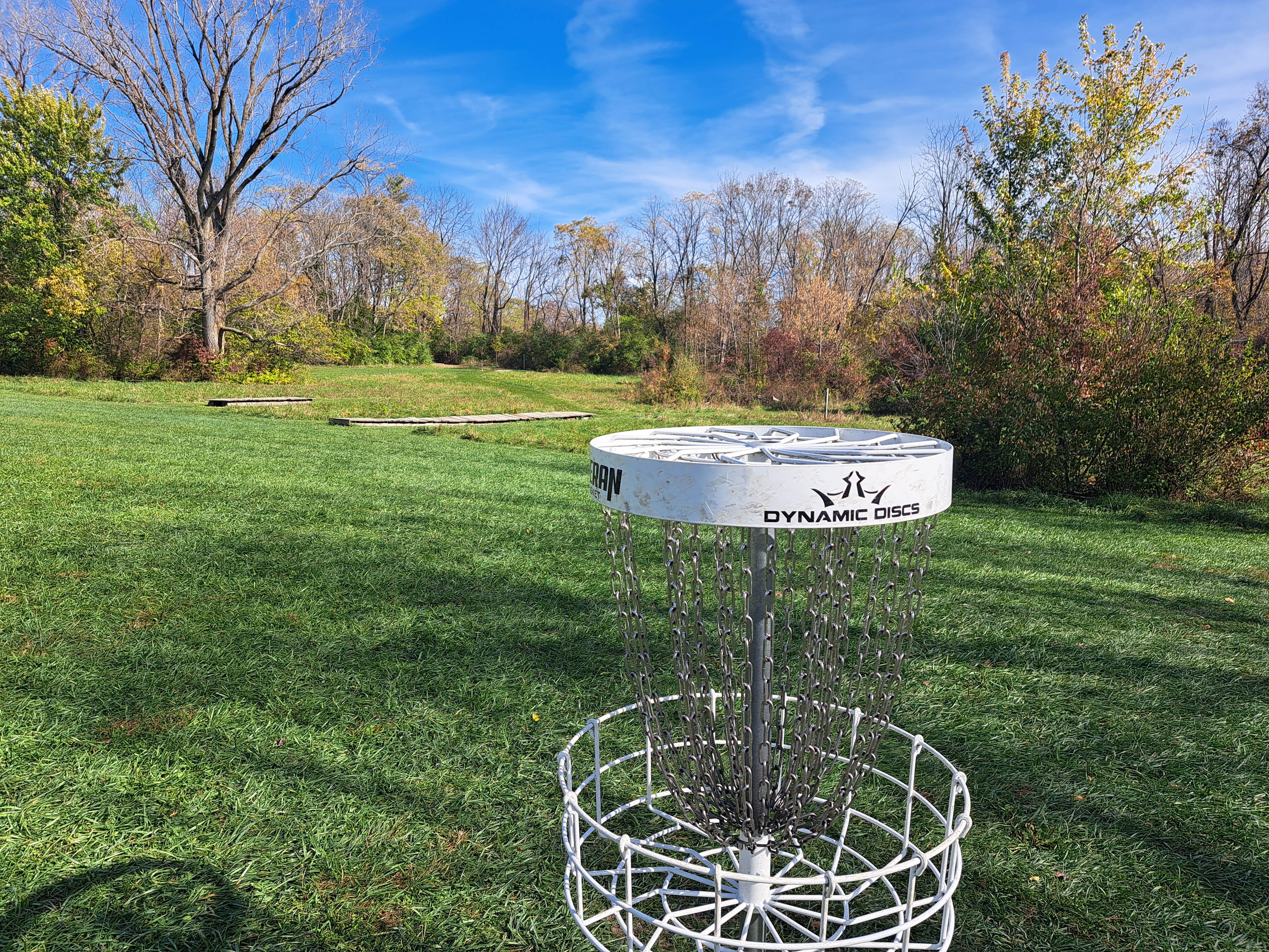
Baskets: Veteran, 1 per hole, but most holes have multiple possible basket positions
Signage: course map near parking lot; hole signs on each tee
Amenities: practice basket, port-o-let, playground, picnic tables
Summary Review: 3.5 Stars (out of 5)
When I first drove into Karohl Park, I saw the park's small size, flat terrain, and relative lack of obstacles, and I thought, "there is no way this park has a quality disc golf course." Yet after playing here, I can assure you that my first thought was wrong even though my observations were mostly true. This parkland consists of old farm fields, but the few areas of trees that exist are used to good effect. The back 9 actually has several densely wooded holes, which I was not expecting when I drove in here. There is no significant elevation anywhere on this course. The front 9 forms a loop through the southern half of the park, while the back 9 forms a loop through the northern half of the park. I did refer to my photo of the course map a couple of times on the middle holes where the two loops adjoin each other, so maybe some signs pointing to the next tee could help. Officially the area is exclusively devoted to disc golf, although I did see some walkers strolling around the course on my visit. Night disc golf is allowed here. Some of the fairways seem rather cramped by underbrush, and this course would be better if some of the shrubs and small trees were trimmed or removed to improve the lines of play. The course constructions are excellent. This course is playable for beginners, but it has enough length and difficulty to keep skilled and experienced players entertained at least occasionally. While this course does not have any truly memorable holes, it does have numerous very good holes. I enjoyed a relaxing round here, and you probably will too.
Hole-by-Hole Review
Distances taken from hole signs. Picture sequence for each hole is 1) tee, 2) approach, 3) basket to tee.
Hole #1: 225/153 feet, par 3 (Basket in long/B position)


Comments: one of the shortest holes on this course is also one of the tightest with dense woods close on either side. You will need a slight left-to-right disc flight to get close to the basket in 1 throw, but a small miss will send your disc into the brush. Precision is necessary on this opening hole. #2 tee is behind the basket and to the right.
Hole #2: 402/342 feet, par 3


Comments: after a short tight hole comes a long open hole; there are 2 tees and 1 basket position on this hole. This hole plays across a small wetland, so it is technically a forced water carry even though you can play from anywhere in the wetland. You could layup short of the wetland, but most players will let it rip, try to clear the wetland, and try to make a birdie. The distance required to clear the wetland is slightly shorter if you use a left-to-right disc flight. #3 tee is to the left and back toward #2 tee.
Hole #3: 333/312 feet, par 3 (Basket in long/B position)


Comments: quite a few large trees come into play on this tee shot, and a bad ricochet off of a tree will send your disc into the dense brush. The left side of the fairway is more open, so favor that side until you get close to the basket. #4 tee is behind the basket and to the right.
Hole #4: 285 feet, par 3


Comments: a cluster of trees with dense underbrush sits in the middle of the fairway directly between the tee and basket, but there is room to go around it on either side. The right option is shorter but tighter, while the left option is longer but more forgiving. You will need to pick a line and execute a throw to score well here. #5 tee is to the right.
Hole #5: 351/321 feet, par 3 (Basket in short/A position)


Comments: the very wide fairway has dense woods along the south park boundary close on the right, but there is plenty of room to the left. The east park boundary is just behind the basket, so don't overthrow. #6 tee is to the left.
Hole #6: 216 feet, par 3


Comments: after several long holes comes a trio of short holes. A tree stands tight on either side close to the tee, but after that this hole really opens up. There are no serious obstacles on this hole, and this is one of the most boring holes on this course. #7 tee is to the right and back toward #6 tee.
Hole #7: 261 feet, par 3


Comments: a sharp dogleg right with dense woods on the inside of the dogleg. You also need to hit a tight gap in the trees just in front of the basket, which is quite hard considering you can't see the gap around the dogleg from the tee. I suggest walking at least the first half of this hole before you throw. #8 tee is to the left on the same side of the old farm field boundary.
Hole #8: 225 feet, par 3


Comments: a very open hole, but there are a few small trees directly in front of the basket. A right-to-left disc flight gives you the most room to work with when approaching the basket. #9 tee is to the right near the old farm field boundary.
Hole #9: 396 feet, par 3


Comments: similar in spirit to hole #5, the wide fairway has the shrubs of the old farm field boundary tight on the right but plenty of room to the left. The basket is hard against the old farm field boundary, so going down the right side provides a shorter but tighter route. This hole is long for a par 3, but the par is reasonable due to the openness. #10 tee is behind the basket and to the right.
Hole #10: 243/186 feet, par 3 (Basket in short/A position)


Comments: a classic tunnel hole that is the tightest hole on this course. Keep your disc flying straight and low or pay the consequences. This hole has 2 tees and 2 possible basket positions. I would not throw from the back tee if someone was sitting at the picnic table just in front of that tee. #11 tee is behind the basket and to the left.
Hole #11: 501/258 feet, par 4/3 (Basket in long/C position)


Comments: this hole starts out very open, but the basket is well into the woods if it is in the B or C position. The woods have a low ceiling, so you will need a low and accurate approach throw to get to the B or C position, creating a fun challenge. This is a very boring hole if the basket is in the A position, which is in front of the woods. I honestly don't know why the A position even exists except maybe as a beginner option. #12 tee is to the right.
Hole #12: 438/402 feet, par 4 (Basket in long/B position)


Comments: the next 2 holes play through the big and dense timber. On a course where most holes are fairly open, holes like these are a nice change of pace. This tight hole is a gradual dogleg right, so accuracy is rewarded more than power despite this hole's length. #13 tee is to the right.
Hole #13: 234/153 feet, par 3 (Basket in short/A position)


Comments: a cluster of trees stands directly between the tee and the A basket position. There is room on either side of the cluster, but the left side is a little roomier. Birdie is very attainable if you pick a line and execute a throw. #14 tee is to the left.
Hole #14: 258/213 feet, par 3 (Basket in short/A position)


Comments: this fairway is wider than the previous 2, but it is also a double dogleg, first left and then right. The underbrush is also denser, and this hole would be better if that brush was cut back. #15 tee is to the left and back toward #14 tee.
Hole #15: 375/252 feet, par 3 (Basket in long/B position)


Comments: this hole has 2 tees and 2 possible basket positions. Underbrush really cramps the line of play from the back tee, and cutting it back would allow for a wider range of tee shots. Once you get out of the woods, there are no other obstacles on this hole. #16 tee is to the left and almost all of the way back toward the #15 short tee.
Hole #16: 336/312 feet, par 3 (Basket in long/B position)


Comments: a sweeping dogleg left with dense woods guarding the inside of the dogleg, you can't see the basket from the tee. The fairway is rather spacious, so you have room to work your disc around the dogleg. A few trees guard the front of the basket, but the gaps between the trees are wider than on hole #7. This hole is a fair and fun test. #17 tee is to the right on the same side of the old farm field boundary.
Hole #17: 399 feet, par 3


Comments: the course closes with 2 long and mostly open holes with the old farm field boundary guarding the entire left side. This hole is a slight dogleg left. There is plenty of room out to the right, but this hole's length forces most players to challenge the tree line to the left if you want a realistic birdie chance. #18 tee is to the right.
Hole #18: 426/326 feet, par 3 (Basket in short/A position)


Comments: a long straight hole, the fairway goes straight through a tight gap in a row of trees. The A basket position is actually in the middle of that gap. Thus, you need some accuracy (or maybe some luck) if the basket is in the B position. This is a solid, somewhat exciting finishing hole on a solid, somewhat exciting course. The parking lot is behind the basket.