Thursday, July 13, 2023

Southside Park Disc Golf Course near Greenville, SC

Basic Information

Course Location: Southside Park
Geographic Location: Simpsonville, SC (34.74278, -82.30276)
Date Visited: June 2023
Number of Holes: 9
Course Length: 1868 feet, par 27
Cost to Play: free
Difficulty Level: recreational, low
Carts: should be fine here
Potential to Lose Discs: low
Course Walkabout Video

Driving Directions: On the south side of Greenville, take I-385 to East Standing Springs Road (exit 30).  Exit and go south on East Standing Springs Rd.  Drive East Standing Springs Rd. south 0.9 miles to Baldwin Road and turn right on Baldwin Rd.  The park entrance is 0.7 miles ahead on the left.  Turn left to enter the park, and park at the far side of the first parking area on the right.  #1 tee is 20 feet up the hill from the southwest corner of this parking lot.

Course Constructions:

Tees: 1 per hole, mostly rubber mats; 1 is asphalt
Baskets: Discatcher, 1 per hole, like new on my visit
Signage: none, except tee markers
Amenities: trash can, other amenities elsewhere in the park

Summary Review: 2 Stars (out of 5)

Opening earlier this year, the disc golf course at Greenville County's Southside Park is a short 9 hole recreational course with a mixture of open and heavily wooded holes.  All holes are under 300 feet in length.  The course is routed more or less in a circle with the #9 basket about 200 feet from the #1 tee.  Some concrete tees and some hole signs would be nice upgrades.  Some of the fairways on the wooded holes will need to be re-cleared often, and the course plays through a low area in the woods that does not drain well.  Thus, mud can be an issue if it has rained recently.  Although there are no official roads or walking trails near the course, people seem to enjoy walking their dogs in the mowed-grass part of the course, so you need to watch for pedestrians and doggy dirt.  Overall, course maintenance was rather good when I came here.  While this course is definitely not a destination course, it is located only a few minutes off of I-385, and it keeps you interested at least on occasion.  This course is worth a stop for a quick and easy half-round if you are driving through the area.

Hole-by-Hole Review 

Distances taken from dgcoursereview.com; link provided above.  Picture sequence for each hole is 1) tee, 2) approach, 3) basket to tee.

Hole #1: 272 feet, par 3
Comments: the longest hole on this course, it is completely open with no obstacles and completely boring; enough said.  #2 tee is behind the basket.

Hole #2: 218 feet, par 3
Comments: the basket is located behind a cluster of trees, and from the tee it looks like you could go around the cluster to the left or to the right.  However, there are more trees behind #3 tee to the left that will block your path to the left, so you have to go right of the trees.  Once you realize the location of the trees, a good right-to-left throw will set up a birdie opportunity.  #3 tee is front and left of the basket; walk back out of the trees and look to the right.

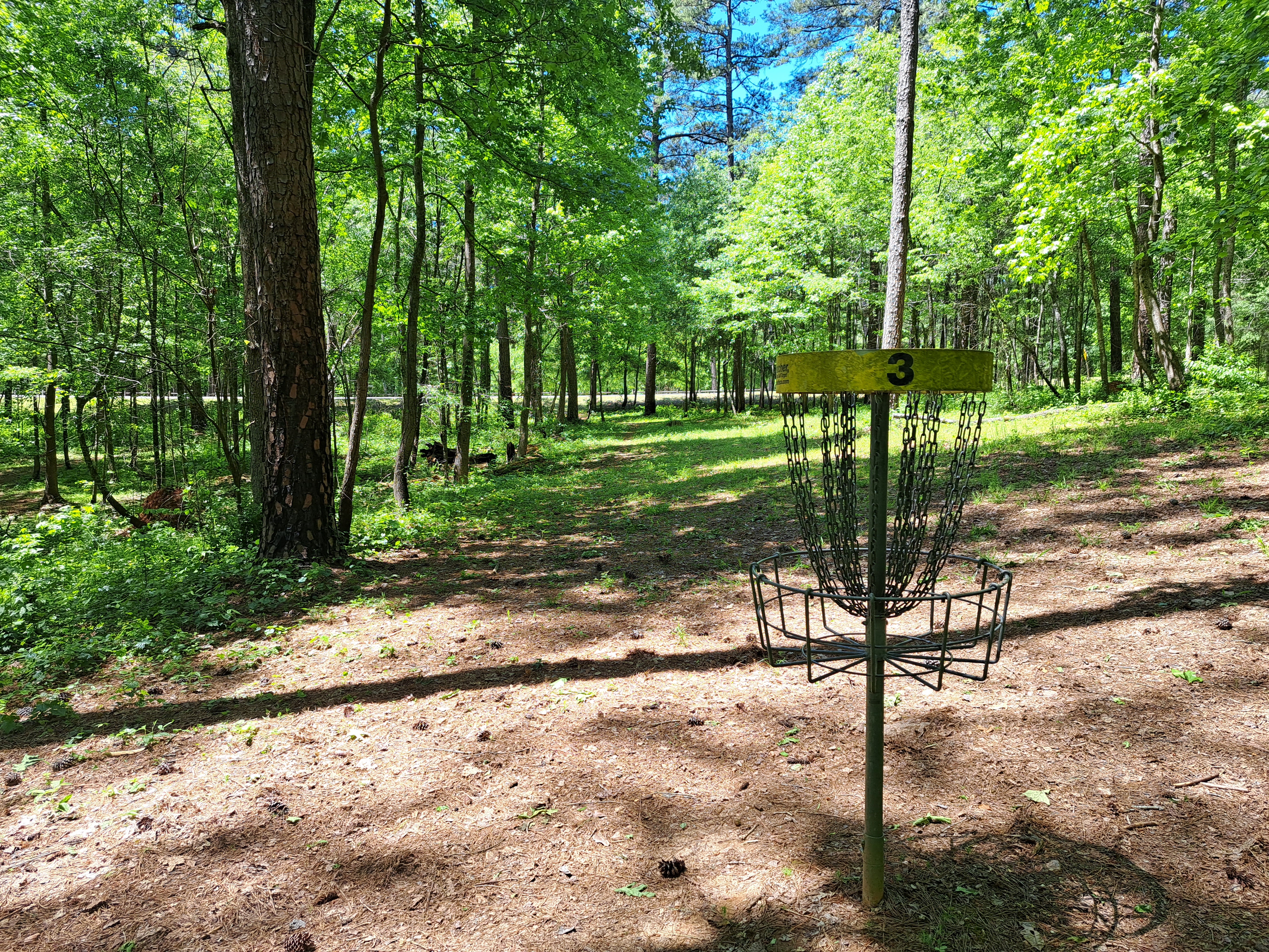
Hole #3: 212 feet, par 3
Comments: another wide open hole protected only by a strange mound about 50 feet in front of the basket.  #4 tee is atop the concrete structure to the right.

Hole #4: 225 feet, par 3
Comments: the last of the completely open holes, it is slightly downhill because the tee is located atop a strange concrete structure.  I could not find any history about this structure, but it looks maintenance/landscaping or industrial in nature.  #5 tee is in the woods behind the basket.

Hole #5: 205 feet, par 3
Comments: now the course enters a densely wooded area, where it will stay for the duration.  This slightly downhill hole is fairly tight with the basket behind 1 large tree in particular.  An accurate throw is needed to set-up a birdie opportunity.  #6 tee is behind the basket.

Hole #6: 208 feet, par 3
Comments: another tight, gently downhill hole, but now there is a clear direct line to the basket.  A low straight throw will get the job done here.  This area is the lowest elevation on the course, and mud will be an issue if it has rained recently.  #7 tee is 50 feet downhill behind the basket.

Hole #7: 202 feet, par 3
Comments: this hole plays back uphill, but it is easily as tight as the previous two holes.  The large number of small trees allow several possible lines of attack.  There is a small gap to the left or a small gap to the right you could try to thread a disc through; the gap directly in front of the basket is too narrow for my risk-tolerance.  A good strategy and good throw are necessary to have a chance at birdie, and this is the hardest hole on this course.  #8 tee is to the left.

Hole #8: 156 feet, par 3
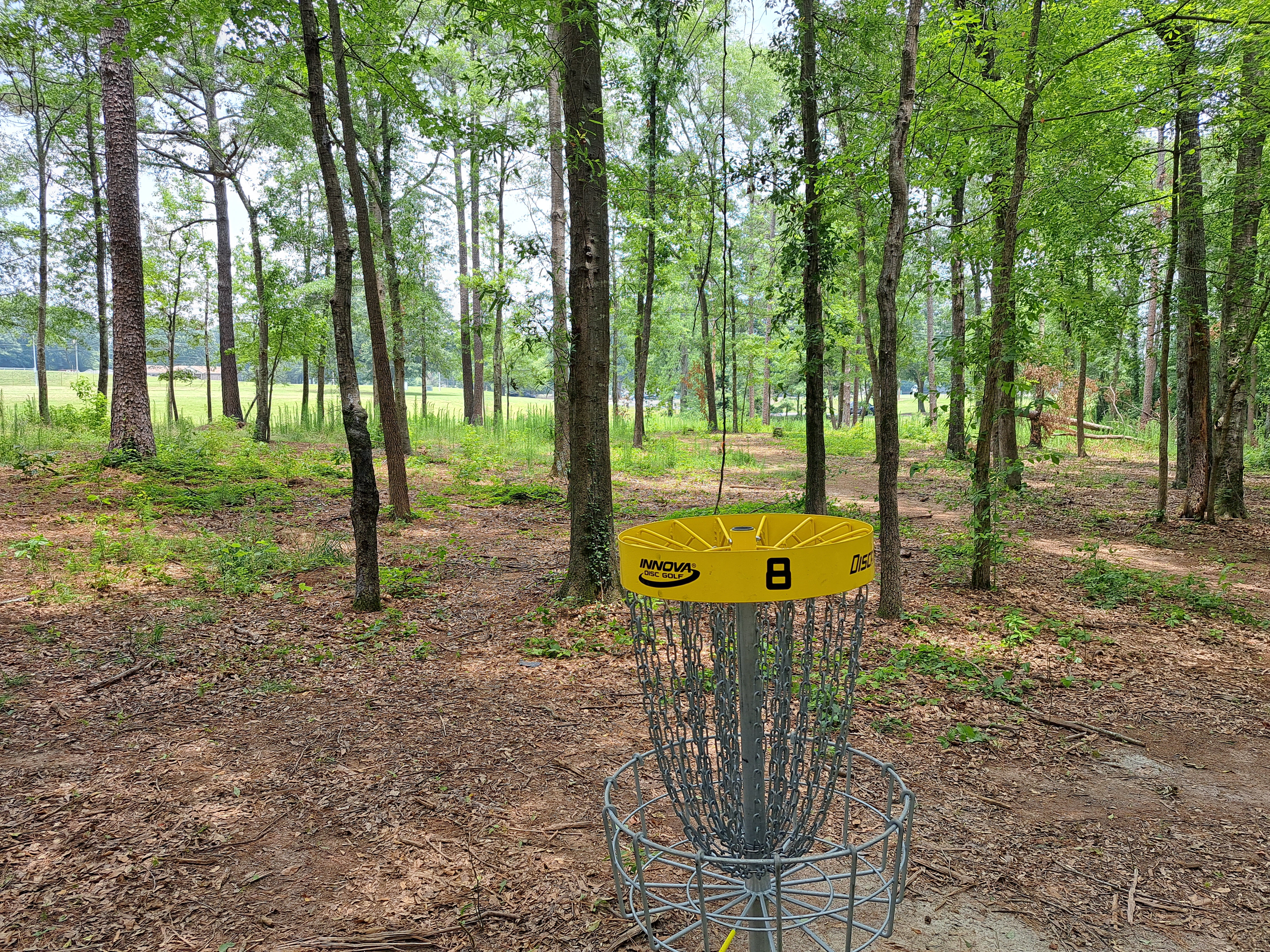
Comments: a cluster of small trees directly between the tee and the basket force you to go left or right.  A sign on the first tree says "8 mando" with an arrow pointing left and "17 mando" with an arrow pointing right, suggesting they might be planning to add a second nine here using the duplication method.  I don't think adding a second 9 holes on a course like this adds much, and I prefer the option of going left or right to force the player to make a choice and execute a throw.  #9 tee is to the right.

Hole #9: 170 feet, par 3
Comments: still heavily wooded but not as tight as some previous holes, this hole favors a right-to-left disc flight, and a good throw will set-up a birdie.  This hole offers a mild ending to the wooded part of this course.  The parking lot is to the right.

Wednesday, July 5, 2023

Fort Yargo State Park Disc Golf Course

Basic Information

Course Location: Fort Yargo State Park
Geographic Location: south of Winder, GA (33.96924, -83.73191)
Date Visited: May 2023
Number of Holes: 18
Course Length: 4815 feet, par 57
Cost to Play: $9 ($5 park entrance fee plus $4 disc golf fee; annual passes available)
Difficulty Level: recreational, high
Carts: usable but expect some rough terrain and downed limbs
Potential to Lose Discs: medium due to dense woods
Course Walkabout Video, Front 9:
Course Walkabout Video, Back 9:

Driving DirectionsFrom Athens or I-85, take SR 316/US 29 to SR 81; there is a traffic light at this intersection.  Go north on SR 81.  Take SR 81 north 2.5 miles to the main park entrance.  Turn right to enter the park.  Pay the entrance fee and disc golf fee at the gatehouse, then turn right at the intersection in front of the Visitor Center.  Drive the main park road 0.8 miles to the paved disc golf parking area and restroom building on the left.  #1 tee is in the woods a short distance back out the road on the same side as the parking lot; look for the welcome sign and the practice basket.

Course Constructions:

Tees: concrete, 1 per hole
Baskets: Discatcher, 1 per hole.  1 was damaged on my visit.
Signage: welcome sign near #1 tee; hole sign on each tee.  3 hole signs were missing on my visit.
Amenities: restrooms, practice basket, hiking trail, playground, other amenities elsewhere in the park

Summary Review: 3 Stars (out of 5)

The disc golf course at Fort Yargo State Park occupies a rolling heavily wooded piece of land that overlooks Marbury Creek Reservoir, the park's central lake.  Most holes are short with tight fairways, although 2 holes are longer and more open.  It would be nice to have more variation in hole length, especially on the front 9, but that might be difficult to achieve given the area they had to work with.  Except for finding #12 tee, I had no trouble following the course route.  A hiking trail winds near the course, but it rarely comes into play.  Thus, I would say this area is almost exclusively devoted to disc golf.  The course's constructions will draw no complaints from most people.  Poison ivy grew throughout the rough when I came here, and several fairways had downed limbs or undergrowth that needed to be cleared.  There is also the issue of the missing hole signs.  Given the high use fees, I would expect better maintenance than this.  For the most part, this is a pleasant if somewhat repetitive disc golf experience with a couple of more interesting holes, and most players will enjoy a casual round here provided you are willing to pay the park's fees.

Hole-by-Hole Review 

Distances taken from hole signs where possible; dgcoursereview.com otherwise (link provided above).  Picture sequence for each hole is 1) tee, 2) approach, 3) basket to tee.

Hole #1: 252 feet, par 3
Comments: a slight dogleg right and slightly downhill, this hole has a well-defined but tight fairway.  An accurate left-to-right throw is required to get close to the basket with the tee shot.  The rough is very green in the summer and dense enough that you could possibly lose a disc there.  Also, beware of poison ivy in the rough.  #2 tee is behind the basket and to the left.

Hole #2: 222 feet, par 3
Comments: this hole is tighter than hole #1, plays the opposite direction, and is a slight dogleg left.  Now you'll need an accurate and low right-to-left throw.  #3 tee is up the path behind the basket.

Hole #3: 237 feet, par 3
Comments: this fairway is a little wider than the previous two.  Despite the sharp dogleg right, a good throw will lead to a birdie opportunity here.  #4 tee is to the left.

Hole #4: 268 feet, par 3
Comments: tight and gradually uphill, this hole is of the same spirit as the previous three but a smidge longer and harder.  #5 tee is uphill to the left.

Hole #5: 250 feet, par 3
Comments: almost a repeat of the previous hole but not quite as uphill.  #6 tee is to the left.

Hole #6: 225 feet, par 3
Comments: finally something a little different!  This hole is still tight and heavily wooded, but it plays dramatically downhill with the lake through the trees in the background.  An overthrow could roll downhill into the lake or at least across the hiking trail behind the basket.  I'm not sure this is my favorite hole on this course, but it might be the most scenic and dramatic.  #7 tee is to the right.

Hole #7: 223 feet, par 3
Comments: playing the opposite direction as #6, this hole plays uphill with the basket hidden over the ridge.  This fairway is easily as tight as any fairway so far.  #8 tee is to the left.

Hole #8: 219 feet, par 3
Comments: another very tight but mercifully short and slightly downhill hole.  The lake is again visible behind the basket, and this hole is similar to hole #6 but with less elevation change.  #9 tee is to the right.

Hole #9: 182 feet, par 3
Comments: the only hole on this course under 200 feet in length, this hole is very tight and plays over a low ridge.  A good, straight, low throw actually gives a good chance at birdie due to this hole's short length.  #10 is across the gully to the left.  To get to the tee, walk back downhill to the hiking trail, cross the gully on the nice wooden trail bridge, and look to the right.

Hole #10: 336 feet, par 4
Comments: this hole is short for a par 4, but 2 factors need to be considered: 1) the fairway is the usual degree of tightness for this course, and 2) it plays straight uphill for its entire distance.  Thus, this par is reasonable here, and this hole is significantly harder than any par 3 you have played so far.  #11 tee is to the left.

Hole #11: 358 feet, par 4
Comments: a parallel hole playing the opposite direction as the previous hole and therefore playing downhill for its entire distance.  The fairway is actually one of the widest so far, but the tree canopy forces you to keep your disc low.  Maybe this hole should be a par 3.  I like these two slightly longer holes because they give this course a little variety, which has been sorely lacking so far.  #12 tee is the hardest one on this course to find. Walk downhill behind the basket to the hiking trail, turn right, walk several hundred feet, passing under a power line in the process, to where the trail curves left.  #12 tee is to the right at this curve in the trail.

Hole #12: 280 feet, par 3
Comments: a gradual dogleg right, this hole plays through a strange tight sunny corridor in the woods, but half of the corridor is too overgrown to be considered fairway.  I would like this hole better if the entire clearing was mowed to fairway height.  Also, this may be the flattest hole on this course in terms of elevation.  #13 tee is behind the basket.

Hole #13: 292 feet, par 3
Comments: the next 4 holes form a small horseshoe with #16 basket about 30 feet to the right of this tee.  This hole is tight, flat, and somewhat unremarkable.  #14 tee is behind the basket.

Hole #14: 248 feet, par 3
Comments: another tight, flat hole similar to the previous one but slightly shorter.  #15 tee is uphill to the right.

Hole #15: 255 feet, par 3
Comments: a mandatory (mando) just in front of the tee forces you to throw a right-to-left tee shot on this dogleg left, but the trees are dense enough to make any line to the left unappealing regardless.  All possible lines are tight, and a slight downhill followed by a slight uphill makes this hole a little more interesting.  #16 tee is to the right.

Hole #16: 238 feet, par 3
Comments: this slightly downhill hole is also a slight dogleg right, but it is short enough that a good throw will set up a birdie opportunity.  #17 tee is uphill to the left.

Hole #17: 480 feet, par 4
Comments: the longest, possibly most boring, and definitely least scenic hole on this course, this dead straight hole follows a power line corridor downhill for its entire distance.  The only obstacles on this hole are the power line poles.  Maybe you could consider the openness a nice change from the tight wooded holes that pervade the rest of the course, but that's being generous.  #18 tee is in the woods behind the basket.

Hole #18: 250 feet, par 3
Comments: back in the woods, the finishing hole is straight, tight, gradually uphill, and rather unmemorable.  It typifies a course that features a couple of memorable holes scattered among a lot of sameness.  The restroom building and parking lot are behind the basket.