Thursday, December 28, 2023

Rocky Fork State Park, South Beach Disc Golf Course

Basic Information

Course Location: Rocky Fork State Park, South Beach
Geographic Location: southeast of Hillsboro, OH (39.18211, -83.47666)
Date Visited: October 2023
Number of Holes: 9
Course Length: 2710 feet, par 27
Cost to Play: free
Difficulty Level: recreational, medium
Carts: should be fine here
Potential to Lose Discs: medium; water in play on several holes
Course Walkabout Video: (coming May 10)

Driving Directions: From Hillsboro, take SR 124 east 7.5 miles to SR 506.  Continue straight to begin heading east on SR 506.  Drive SR 506 east 0.4 miles to Blue Ribbon Road and turn left on Blue Ribbon Rd.  Blue Ribbon Rd. ends at the state park's South Beach area.  Park in the large paved beach parking lot; #1 tee is to the left behind the practice basket and course map sign.

Course Constructions:

Tees: concrete, 1 per hole, some in bad shape on my visit
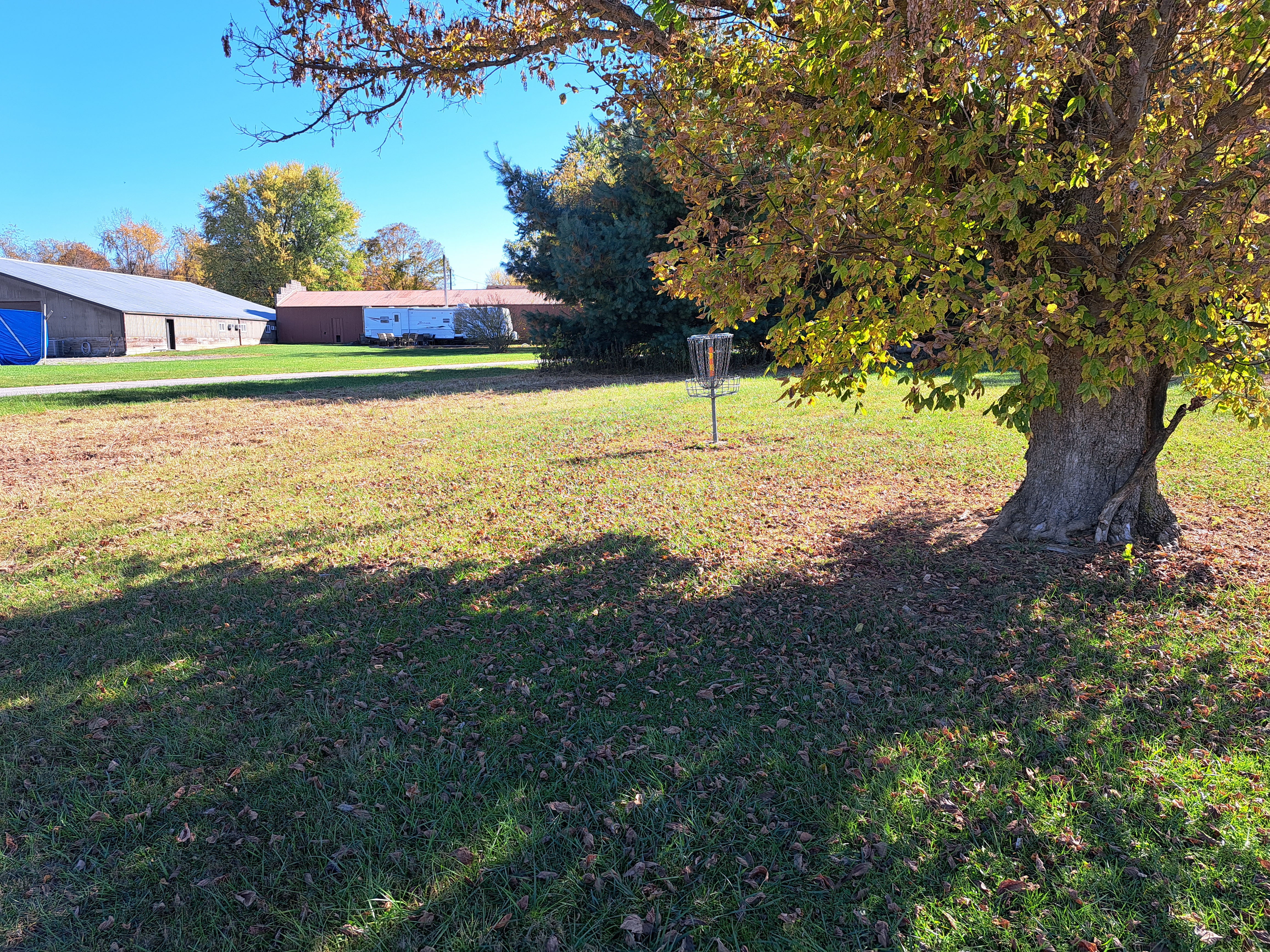
Baskets: DGA, 1 per hole, older but in good shape on my visit
Signage: course map near #1 tee, hole sign on each tee
Amenities: restrooms, picnic shelter, beach, practice basket, other amenities elsewhere in the park

Summary Review: 1.5 Stars (out of 5)

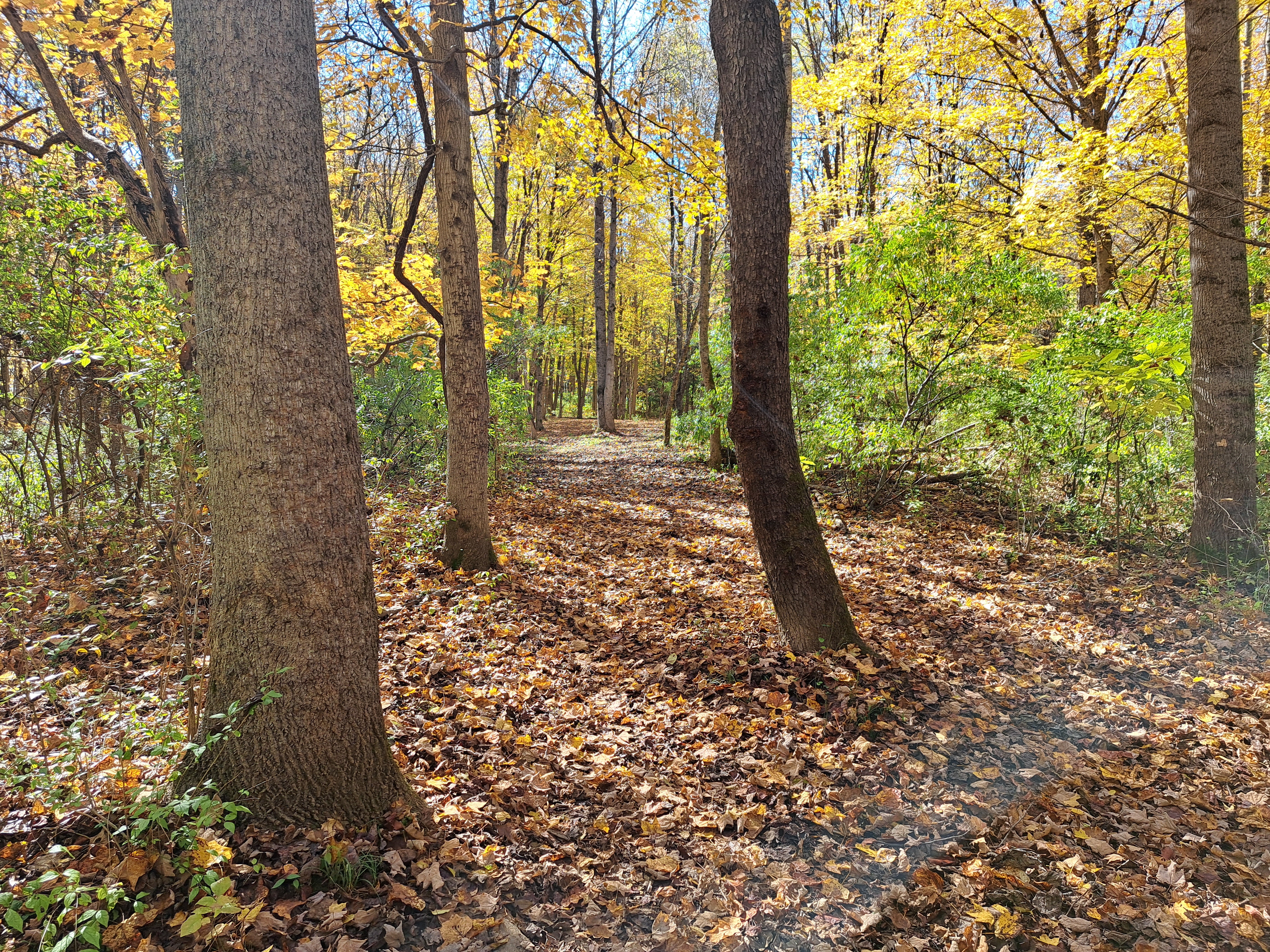
The South Beach disc golf course at Rocky Fork State Park is a rare example of a prairie-style course in this part of the world.  Prairie-style courses are characterized by their flat terrain and open grassy landscapes.  They typically have mowed-grass fairways and tallgrass/wildgrass rough.  Prairie-style courses play best when the wind is high, and thus they are common in Great Plains states such as Texas, Oklahoma, and Kansas.  This course is definitely exposed to the wind coming off of Rocky Fork Lake, but the wind was rather calm on my visit.  The terrain is completely flat with no observable elevation change on any hole.  The course route is not the best: the first 8 holes form a loop with hole #9 playing away from the parking area, thus forcing you to walk all the way back up hole #9 at the end of your half-round.  That said, I had no trouble following the course route.  Course maintenance is an issue here: a couple of the tee pads were literally falling into the lake on my visit.  I was the only person on the course when I came here on a nice fall Monday afternoon, so this course is not heavily used, at least not in the shoulder season.  Most players will not like this style of course due to the lack of hole variety, and it offers very little challenge when the wind is down.  I would much rather play at nearby Paint Creek State Park than play here.

Hole-by-Hole Review 

Distances taken from hole signs, pars from dgcoursereview; link provided above.  Picture sequence for each hole is 1) tee, 2) approach, 3) basket to tee.

Hole #1: 326 feet, par 3
Comments: Every hole on this course is very open, so I will write that statement once and never again.  A single tree guards the front right of the basket, and the mowed-grass fairway is fairly narrow for a hole of this length.  Fortunately, it appeared that they had just mowed the rough when I played here, so the "rough" was not very rough.  #2 tee is beside the park boundary to the right.

Hole #2: 464 feet, par 3
Comments: very long for a par 3, dense woods and the park boundary go down the entire left side.  Thus, you must make your miss in the rough to the right and not in the woods to the left.  The basket sits on a peninsula with Rocky Fork Lake on 3 sides, so approaching this basket from distance comes with risk.  Maybe this hole should be a par 4, especially if it is into the wind.  #3 tee is to the right, beside the lake.

Hole #3: 223 feet, par 3
Comments: this is the first of 3 holes that play along side the lake, which is to the left in all 3 cases.  The concrete tee pad on this hole is literally falling into the lake.  Keep your disc to the right to avoid the lake and you should be fine.  #4 tee is to the right, about 200 feet across the field.  The tee you can see through the pine trees behind the basket is #5 tee.

Hole #4: 237 feet, par 3
Comments: pine trees guard either side of the fairway near the basket, but the fairway is pretty wide.  A good straight tee shot will set up a birdie.  #5 tee is to the left, near #3 basket.

Hole #5: 199 feet, par 3
Comments: the tightest hole on this course, a pine tree guards either side of the entrance to the basket area, and the gap between the pine tree branches is only about 10 feet wide.  But this hole is short enough that a good throw will still lead to a birdie even if it grazes those branches.  If your disc goes into the body of the tree, it will likely get swallowed alive by the tree.  #6 tee is to the left near the picnic shelter.

Hole #6: 308 feet, par 3
Comments: a slight dogleg right, a couple of pine trees guard the inside of the dogleg.  There is more room to maneuver a disc on this hole than on the previous hole.  #7 tee is to the right near the lakeshore.

Hole #7: 263 feet, par 3
Comments: the next 2 holes are the other 2 lakeside holes.  This hole is a dogleg right that curves with the lakeshore, but nothing guards the inside of the dogleg.  Thus, take a direct path to the basket, keep your disc to the right, and take the lake out of play.  #8 tee is to the right near the lakeshore.

Hole #8: 264 feet, par 3
Comments: same as the previous hole but the basket is closer to the lake, in fact only about 10 feet away from it.  Thus, more caution is warranted, but there is still plenty of room to the right.  #9 tee is several hundred feet to the right on the other side of the parking lot.

Hole #9: 426 feet, par 3
Comments: the closing hole has a forced water carry; it is about 150 feet to clear the pond.  No other obstacles stand between the tee and basket, and this hole makes a rather uninspiring end to a rather uninspiring course.  The parking lot is behind you, beside #9 tee.

Sunday, December 24, 2023

Paint Creek State Park Disc Golf Course

Basic Information

Course Location: Paint Creek State Park
Geographic Location: between Hillsboro, OH and Chillicothe, OH (39.26738, -83.38000)
Date Visited: October 2023
Number of Holes: 21
Course Length: 6063 feet, par 69
Cost to Play: free
Difficulty Level: recreational, high
Carts: should be fine here
Potential to Lose Discs: medium due to dense woods in rough
Course Walkabout Video, Front 7: (coming November 15)
Course Walkabout Video, Middle 7: (coming November 22)
Course Walkabout Video, Back 7: (coming November 29)

Driving Directions: Just east of the Ross/Highland county line, take US 50 to Rapid Forge Road and turn north on Rapid Forge Rd.  Drive Rapid Forge Rd. north 3.7 miles to Taylor Road and turn left on Taylor Rd.  Drive Taylor Rd. west 0.8 miles to the signed campground entrance on the left.  Turn left to enter the state park campground, and park in the gravel lot on the right across the road from the campground store.  #1 tee is on the west side of the road just north of the gravel lot.

Course Constructions:

Tees: concrete, 1 per hole
Baskets: Discatcher, 1 per hole
Signage: hole sign on each tee, some signs pointing to next tee, scorecard available at camp store
Amenities: some benches, some trash cans, campground, mini golf, other amenities elsewhere in the park

Summary Review: 4 Stars (out of 5)

The disc golf course at Paint Creek State Park occupies a mostly flat piece of land near the entrance to the park's main campground.  The course has a nice mixture of open and heavily wooded holes, long and short holes.  That said, most of the open holes come at the beginning or end of the course with all of the heavily wooded holes in the middle.  The terrain is very flat with only a couple of holes offering any significant elevation change.  Every hole offers a solid challenge, but there are no truly memorable holes on this course.  Also, some of the par 4s maybe should be par 3s.  The course maintenance was fine when I came here.  The course route forms a true loop, but I would have had a hard time finding holes #6 and #7 north of the Taylor Road had I not picked up a free course map and scorecard at the campground store.  Signs mark each tee, but those signs were somewhat faded on my visit.  This course could really benefit from some alternate tees and basket locations; this feature has become standard on most top courses these days.  Overall, this is a solid course with a nice variety of holes that will challenge most players at least on occasion.  Yet it has no signature hole and may not have enough variation to keep you coming back again and again.

Hole-by-Hole Review 

Distances taken from hole signs.  Picture sequence for each hole is 1) tee, 2) approach, 3) basket to tee.

Hole #1: 421 feet, par 4
Comments: you can't see the basket from the tee, but it is near the flagpole you can see over the edge of the campground road.  This hole is very open, but the campground road is definitely in play, and it is a potential safety hazard.  Check for cars on the road before you throw.  At least the road's dirt banking provides some elevation on an otherwise boring hole.  #2 tee is at the edge of the woods to the left.

Hole #2: 342 feet, par 4
Comments: now the course heads away from the road and into a lightly wooded area with dense understory in the rough, where it will stay for the next 3 holes.  This hole goes west for about 300 feet before curving sharply left to reach the basket.  The basket is surrounded on 3 sides by dense woods, which discourages you from getting too aggressive with your tee shot.  The woods also mean you have to go back out the way you came in to get to the next tee.  Maybe this hole should be a par 3.  #3 tee is to the north, back up the fairway.

Hole #3: 217 feet, par 3
Comments: a copy of the previous hole but shorter.  #4 tee is is to the east, back up the fairway.

Hole #4: 217 feet, par 3
Comments: a slight dogleg left, this is another mostly open hole with dense woods on either side.  Watch out for the cedar trees in this part of the course: they will really eat up your disc.  Follow the trail behind the basket to #5 tee, which is near the campground entrance road.

Hole #5: 452 feet, par 4
Comments: the longest hole on this course, this hole is the third consecutive dogleg left.  It plays through a 40 foot wide mowed-grass area with dense woods on the left and the campground road on the right.  The road is out-of-bounds (OB), as it should be, but it still presents the same safety hazard as it did on hole #1.  #6 tee is across Taylor Road behind the basket (not the campground road to the right of the basket) and to the right.

Hole #6: 356 feet, par 4
Comments: the next 2 holes are the only holes on the north side of Taylor Road, which creates an odd routing quirk.  This hole starts in a wide open mowed-grass field, but it passes through a very tight gap in a row of pine trees before heading into an area surrounded on 3 sides by dense woods.  This hole is short for a par 4, but 4 would be a decent score if you got a bad ricochet off of one of those pine trees.  #7 tee is to the right.

Hole #7: 331 feet, par 3
Comments: kind of the inverse of the previous hole, now you throw out of a tight chute with a low ceiling before poking through a row of pine trees right in front of the basket.  This hole was significantly easier before trees grew and started crowding the chute.  #8 tee is back on the south side of Taylor Road but on the east side of the campground road.

Hole #8: 261 feet, par 3
Comments: similar to hole #6 but without the row of pine trees.  The final approach to the basket is quite tight.  #9 tee is behind the basket.

Hole #9: 286 feet, par 3
Comments: now comes the first pine planting hole, as indicated by pine trees growing in row and column configuration.  This tight fairway heads straight between two of the columns, but the basket is offset to the right of those columns, which creates a clever challenge.  #10 tee is to the left; the tee you can see behind the basket is #17 tee.

Hole #10: 226 feet, par 3
Comments: this hole promptly exits the pine planting.  The super tight fairway and gradual dogleg right make this short hole a real challenge.  The woods are super dense and make any recovery throw very challenging.  #11 tee is to the left.

Hole #11: 214 feet, par 3
Comments: another very tight hole, but this one is a gradual dogleg left.  The woods near the fairway are not quite as dense as on the previous hole.  #12 tee is to the right.

Hole #12: 245 feet, par 3
Comments: yet another very tight hole, and another gradual dogleg right.  #13 tee is to the left.

Hole #13: 221 feet, par 3
Comments: the next 2 holes are the only holes on this course with any significant elevation change.  This hole is another tight dogleg right, but the second half of the hole plays moderately downhill to the basket.  There is not a lot of underbrush near the fairway, so recovery is easier if/when you hit a tree.  #14 tee is behind the basket.

Hole #14: 178 feet, par 3
Comments: as you would expect, this hole plays back uphill, and the hill gets pretty steep near the basket.  This hole is dead straight, and it is tight but not as tight as some previous holes.  Thus, it is a very fair challenge.  This hole is the closest thing this course has to a signature hole.  #15 tee is uphill behind the basket.

Hole #15: 293 feet, par 4
Comments: now back on the flat ridgetop, this gradual dogleg left is easily as tight as any hole we have seen so far.  Two accurate throws will be needed to set-up a birdie opportunity here.  #16 tee is to the left.

Hole #16: 313 feet, par 3
Comments: finally a fairway with a little more width; welcome back to the pine planting!  As you would expect in a pine planting, the fairway is dead straight, but the basket is offset a few feet to the right.  This hole is another nice, fair challenge.  #17 tee is behind the basket and to the left.

Hole #17: 229 feet, par 3
Comments: very similar to hole #9 but shorter.  #18 tee is to the right.

Hole #18: 316 feet, par 4
Comments: another pine planting hole similar to #9 and #17 but longer and with a higher par.  The basket on this hole is offset to the left instead of to the right, and it has 2 different numbers.  The number on the front is correct; the number on the back is not.  #19 tee is to the right.

Hole #19: 325 feet, par 3
Comments: another pine planting hole with the basket offset to the right.  The area around the basket is surprisingly open.  #20 tee is to the right.

Hole #20: 245 feet, par 3
Comments: now at the edge of the pine planting, this sweeping dogleg left is heavily wooded, but the fairway is wider than some holes you have played previously.  The woods on either side are very dense, creating a tough recovery throw or even a lost disc if you end up there.  #21 tee is to the left near the edge of the woods.

Hole #21: 375 feet, par 3
Comments:  The course ends by coming out of the woods and back into the open area you started in.  The basket is not visible from the tee; it lies over the ridge behind the center pine tree you see 100 feet in front of the tee.  After you get through the pine trees, your tree problems are mostly over: there are no trees within 100 feet of the basket.  The parking lot is behind the basket and across the campground road.