Saturday, January 8, 2022

River Street Park in Mount Holly, NC

Basic Information

Course Location: River Street Park
Geographic Location: Mount Holly, NC (35.30101, -81.00703)
Date Visited: December 2021
Number of Holes: 9
Course Length: 2174 feet, par 27
Cost to Play: free
Difficulty Level: recreational, medium
Carts: should be fine here
Beginner Friendly? more yes than no
Potential to Lose Discs: low, but there is a large creek on the course's north boundary

Driving Directions: On the west side of Charlotte, take I-85 to SR 273 (exit 27).  Exit and go north on SR 273.  Drive SR 273 north 3.7 miles to SR 27 and turn right on SR 27.  In quick succession turn left on Lee Street, right on Elm Avenue, and left on River Street, which deadends at the park.  The #1 tee is near the park's restroom building.  If you park in the main parking lot, walk uphill and to the right on the gravel trail that exits the rear of the parking lot to reach the restroom building.

Course Constructions:

Tees: 1 per hole; firmly packed fine gravel in a wood frame.  The gravel was uneven and provided poor footing on my visit.
Baskets: Innova disccatcher; 1 per hole.  Older but in good shape on my visit.
Signage: numbered wooden post to mark each tee.
Amenities: restrooms, basketball court, sand volleyball court, picnic shelters, softball field

Summary Review: 2 Stars (out of 5)

The disc golf course at River Street Park is a short recreational course that plays around and among the park's other facilities.  Perhaps the course's best aspect is its setting: the course plays over rolling terrain with sparse large, old trees and beside tranquil and scenic Dutchman's Creek.  The disc golf aspects leave somewhat to be desired.  The packed fine gravel tees had been compacted in the center by use, thereby making the tee surface uneven.  I could get better footing on the course's regular dirt/grass areas than on these tees.  Also, there are some routing issues.  I had to do some searching to find #4 and #7 tees, and no course map is provided to help.  As is typical for this type of course, the route winds among the park's other amenities, so you have to check for pedestrians and cars before each throw.  Finally, crime may be an issue here.  I saw signs warning against leaving valuables in your car, which is good advice at any park.  Overall, if you play disc golf as a way to get some exercise and enjoy a walk through the park (as I do), then this course is a nice option.  If you play disc golf for the disc golf, then this course leaves somewhat to be desired.

Hole-by-Hole Review 

Distances taken from dgcoursereview website; link provided above.  Picture sequence for each hole is 1) tee, 2) approach, 3) basket to tee.

Hole #1: 287 feet, par 3
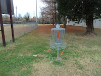
Comments: a completely flat hole across an open mowed-grass field; enough said.  #2 tee is to the right.

Hole #2: 252 feet, par 3
Comments: a replica of hole #1 but playing in the opposite direction.  These first 2 holes are easily the two worst holes on this course.  #3 tee is behind the basket near the left side of the restroom building.

Hole #3: 253 feet, par 3
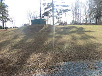
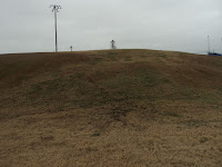
Comments: the tee shot is a blind throw over the left side of the hill; the basket you see on top of the hill is #7 basket.  The smattering of large trees force an accurate throw, and the steep hill can punish a miss to the left or long.  #4 tee is several hundred feet behind the basket downhill beside the creek; follow the gravel access road toward the creek.

Hole #4: 206 feet, par 3
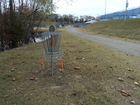
Comments: a single tree stands directly between the tee and basket on this flat creekside hole.  I chose to go right of the tree to take advantage of my natural right-to-left disc flight.  Scenic Dutchman's Creek is far enough left that only a very bad throw will find it.  (Note: the pictures above are tee and approach; I forgot to take a picture from behind the basket on this hole.)  #5 tee is to the right behind the sand volleyball court.

Hole #5: 272 feet, par 3
Comments: this hole plays slightly downhill through a narrow corridor with the sand volleyball court to the left and a picnic shelter to the right.  The basket is about 10 feet from Dutchman's Creek, so don't overshoot.  #6 tee is to the right between the gravel road and the creek.

Hole #6: 215 feet, par 3
Comments: a mostly open hole that is flat at first, but the basket sits on a steep upslope.  Moving the basket to the left would bring more trees into play.  #7 tee is at the far right corner of the main parking lot; look for the painted lines marking the tee box on the asphalt.

Hole #7: 203 feet, par 3
Comments: the shortest hole on this course plays straight uphill (and straight into a headwind on my visit) through a narrow gap between two trees.  Thus, this hole demands an accurate throw to have a birdie opportunity.  The wind will be more of a factor at the top of the hill than elsewhere on the course.  #8 tee is to the left but still on top of the hill.

Hole #8: 240 feet, par 3
Comments: this downhill hole plays through a couple of gaps in a "fence" of trees.  Trains use the railroad behind the basket; they disrupt your mind but not your arm when you throw.  #9 tee is to the left along the park boundary.

Hole #9: 246 feet, par 3
Comments: this downhill dogleg right closing hole might be my favorite hole on the course.  The tee shot is blind, and a left-to-right disc flight around some trees will be required to attack the basket on the first throw.  Dutchman's Creek awaits just beyond the basket to swallow up overthrows.  This is a clever and scenic finishing hole on a clever and scenic course.

Thursday, December 23, 2021

Halls Ferry Park Disc Golf Course in Vicksburg, MS

Basic Information

Course Location: Halls Ferry Park
Geographic Location: south side of Vicksburg, MS (32.31297, -90.86907)
Date Visited: December 2021
Number of Holes: 9 (but 9 more under construction)
Course Length: 3060 feet, par 29
Cost to Play: free
Difficulty Level: recreational, medium
Carts: should be fine here
Beginner Friendly? no, too many safety hazards
Potential to Lose Discs: low

Driving Directions: On the south side of Vicksburg, take I-20 to Halls Ferry Road (exit 1C).  Exit, go south on Halls Ferry Road 1 traffic light, and turn left on South Frontage Road.  Drive South Frontage Rd. east 0.2 miles to Bazinsky Road and turn right on Bazinsky Rd.  Drive narrow and winding Bazinsky Rd. south 0.7 miles, passing the first entrance to Halls Ferry Park, and turn right into the second park entrance, the one at the southeast corner of the park.  Park in the gravel parking lot at this entrance.  The information board, practice basket, and #1 tee are at the back left corner of this parking lot.

Course Constructions:

Tees: dirt/grass tees, 1 per hole; marked with white pegs in the ground
Baskets: Mach X baskets, 1 per hole; in excellent shape on my visit
Signage: information board with course map at parking lot; sign on each tee; #5 tee sign was missing on my visit
Amenities: practice basket, some benches, restrooms beside baseball field near #2 tee

Summary Review: 2 Stars (out of 5)

The disc golf course at Halls Ferry Park is somewhat of a typical city park disc golf course that threads its way among the various athletic fields, tennis courts, and parking lots this park has to offer.  All baseball fields are OB, as are parking lots, tennis courts, roads, and maintenance buildings.  When I came here on a chilly Tuesday morning in early December, I was the park's only user, but the large number of baseball fields and tennis courts indicate that this park could get very crowded on warm-weather weekends.  The athletic fields and parking lots interfere with some throws, so I recommend avoiding this course when the park is crowded.  This course has steeper hills than you might expect for this type of course, and many holes use these slopes effectively as hazards.  Due to a couple of routing quirks, in particular on #4 and #5, I recommend taking a picture of the course map at #1 tee: I needed it to find #4 tee.  Finally, future plans call for adding a second 9 holes that more or less duplicate the current 9, i.e. #10 runs parallel to #1, #11 parallel to #2, and so on.  When I came here, unnumbered baskets had been installed, but no tees had been marked.  As I walked around here, I could see far better ways to add a second 9 compared to using the duplication approach.  As it exists now, this is a solid 9 hole recreational course, but it is not a course worth playing ahead of others.

Hole-by-Hole Review 

Distances taken from hole signs when possible, dgcoursereview.com otherwise (link provided above).  Picture sequence for each hole is 1) tee, 2) approach, 3) basket to tee.

Hole #1: 365 feet, par 3
Comments: a straightforward opening hole made interesting only by the fact that it plays across the brow of a hill.  No other obstacles stand between the tee and the basket.  #2 tee is across the gravel road near the concession/restroom building.

Hole #2: 315 feet, par 3
Comments: the OB baseball field encroaches on the right; otherwise this hole only has a single tree for an obstacle.  The basket sits on a steep upslope at least 20 feet above the fairway.  #3 tee is to the right at the base of the hill.

Hole #3: 244 feet, par 3
Comments: a disappointing hole in the sense that the gravel maintenance road basically IS the fairway.  At least there is a wooded periodic wetland that guards the basket on the right; it is the first real hazard you encounter on this course.  #4 tee is behind the basket, behind the maintenance building, and near the lower tennis courts.

Hole #4: 234 feet, par 3
Comments: a gentle dogleg right, this hole plays under some trees and beside a chain link fence that appears to be part of an old baseball field.  The trees and fence force you to shape your throw carefully, and this is the first hole that involves any real strategy.  #5 tee is up the hill behind the basket at the right end of the upper tennis courts.

Hole #5: 336 feet, par 3
Comments: another wide open hole on which the right-to-left cross slope offers the hole's only real defense.  The tennis courts to the right are OB.  #6 tee is several hundred feet downhill to the left, past #3 basket, beside the outfield fence; the course route crosses itself here.

Hole #6: 203 feet, par 3
Comments: the shortest hole on this course plays through an open area outside one of the baseball outfield fences.  The basket is cleverly perched in an opening in the trees on this area's steepest hillside.  This hole is well-designed considering what the designer had to work with, and it might be my favorite hole on this course.  #7 tee is several hundred feet away at the north end of the parking lot.

Hole #7: 850 feet, par 5
Comments: by far the longest hole on this course, this hole is either completely out of place or a wonderful break from the par 3's depending on whether you love this hole or hate it.  The parking lot is OB, so throwing across its corner offers some risk/reward (and possibly some vehicle damage if cars are parked there when you throw).  The basket is over a brow of a hill near Bazinsky Road.  Personally, I would rather see 2 or 3 shorter holes around the parking lot than one super-long hole across it.  Such a design could also be used to move holes #4 and #5 to the new back 9 and eliminate the routing issue mentioned above.  #8 tee is along the road behind the basket.

Hole #8: 271 feet, par 3
Comments: the most downhill hole on this course is another hole with no obstacles other than the hillside.  A right-to-left throw will cause the disc to land on an upslope, thus maximizing your control.  #9 tee is behind the basket to the left of the baseball field fence.

Hole #9: 242 feet, par 3
Comments: the short finishing hole plays through a narrow corridor between the baseball field's outfield fence on the right and a steep wooded hillside on the left.  This hole feels wedged in, as does much of the course, thus making it a fitting end to this course.