Basic Information
Course Location: Herman Dierks Memorial Park
Geographic Location: De Queen, AR (34.04258, -94.33375)
Date Visited: February 2024
Number of Holes: technically 18, but the two 9's are laid out in duplication with only 9 baskets
Course Length: 2930/2134 feet, par 27
Cost to Play: free
Difficulty Level: recreational, medium
Difficulty Level: recreational, medium
Carts: should be fine here
Beginner Friendly? more yes than no
Potential to Lose Discs: low
DG Course Review Page: https://www.dgcoursereview.com/courses/herman-dierks-dgc.5924
Course Walkabout Video:
Driving Directions: From the intersection of US 70 and SR 41 in De Queen, drive SR 41 south 2 blocks to the park entrance on the right. Turn right to enter the park, and park in the parking lot just past the picnic shelter at the top of the hill. #1 tee is on the south side of the entrance road just west of the picnic shelter.


Course Constructions:
Tees: concrete, 2 per hole, red long tee and blue short tee
Baskets: Mach 5, older but in good shape on my visit
Signage: course map at picnic shelter, hole signs on some tees but most are faded
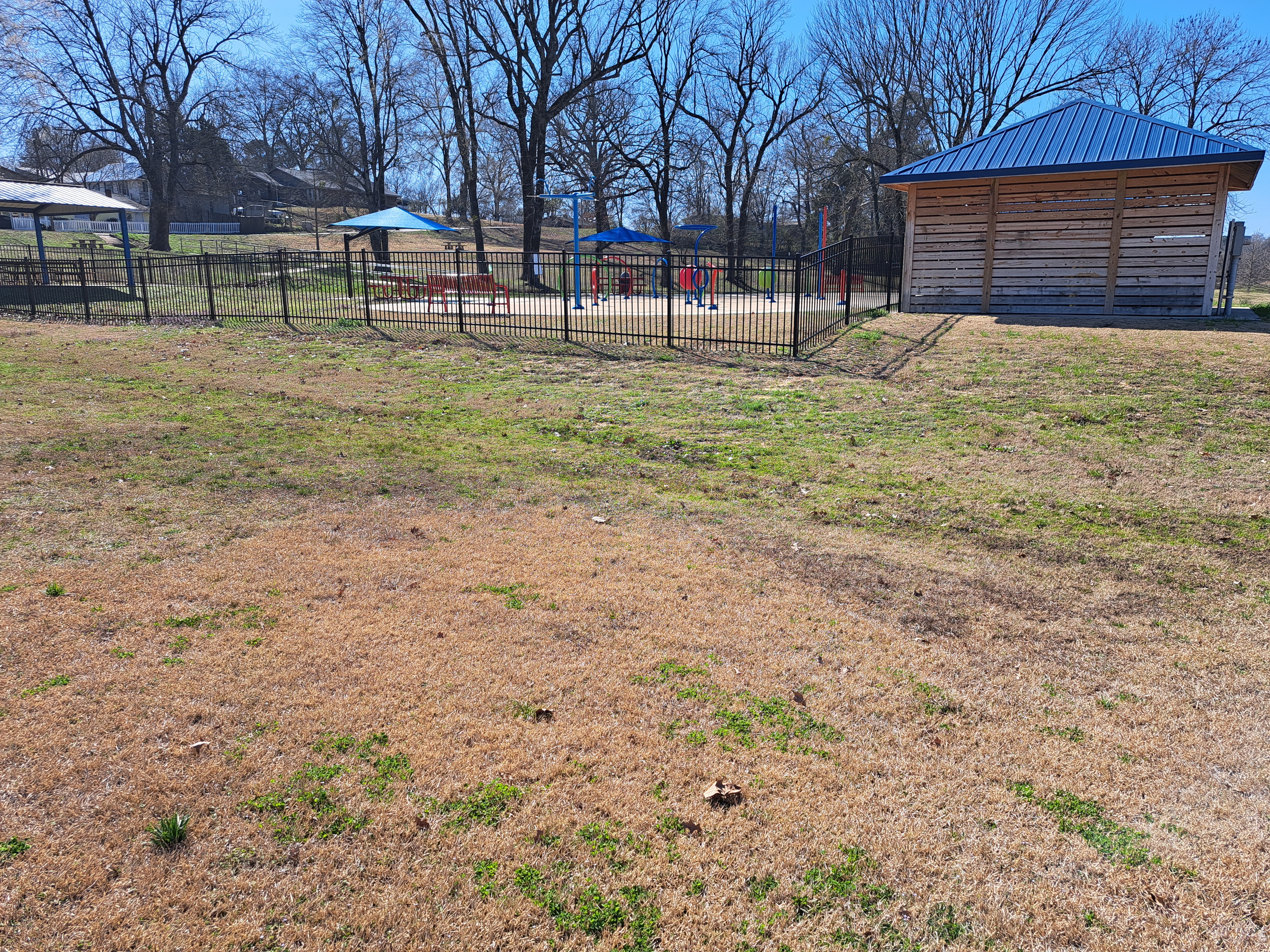
Amenities: picnic shelter, splash pad, soccer field
Summary Review: 2.5 Stars (out of 5)
The disc golf course at Herman Dierks Memorial Park has 18 tees but only 9 baskets. Further, the holes are laid out in duplication (i.e. holes #1 and #10 play to the same basket, as do holes #2 and #11, and so on) with the longer back 9 tees marked with red numbers and the shorter front 9 tees marked with blue numbers. Thus, I view this course as a 9 hole course with 2 sets of tees, and I have reviewed it as such.
As is typical with community park courses, the course is routed around the park's other amenities, which occasionally create safety hazards. Also typical for a community park course, the course has a couple of memorable holes along with many less memorable ones. The course route does form a true loop, but there are a couple of long walks from basket to next tee. Thus, you want to take a picture of the course map behind the picnic shelter before you start. All holes are either completely open or lightly wooded, but the course has enough length to require some quality throws. The moderate amount of elevation is used to good effect. The course was well-maintained on my visit, and the course constructions were older but in good shape except for the signs, which need to be replaced. Overall, this course is slightly better than the typical community park course, and I have rated it as such. I would not go out of my way to play here, but if you find yourself in De Queen, it is worth an hour or so of your time.
Hole-by-Hole Review
Distances taken from dgcoursereview.com; link provided above. Picture sequence for each hole is 1) red tee, 2) approach, 3) basket to tee.
Hole #1: 265/225 feet, par 3


Comments: a gradually downhill hole with 2 trees directly between the tee and basket. There is barely enough room to take a direct line between the trees, but a safer throw would be a sweeping left-to-right disc flight. A small playground to the right makes going around the trees that direction a possible safety problem. #2 tee is behind the basket.
Hole #2: 307/214 feet, par 3


Comments: a flat creekside hole with the park's small stream making its first of several appearances to the right. There are no obstacles between the tee and basket. #3 tee is behind the basket and to the left.
Hole #3: 451/255 feet, par 3


Comments: another flat, completely open hole with the stream to the right. #4 tee is to the right on the current (west) side of the stream.
Hole #4: 352/247 feet, par 3


Comments: the third consecutive creekside hole, but this one has a forced carry over the stream. The rocky stream is shallow enough that you should not lose a disc if you throw it there. A slight upslope in front of the basket makes this hole a little longer than you might think from the tee. #5 tee is behind the basket near the splashpad.
Hole #5: 366/240 feet, par 3


Comments: the red tee requires a forced carry over the park's splash pad, which is an obvious safety hazard and bad design. Moving the red tee over beside the blue tee would solve this problem. The rest of the hole plays through a row of trees and moderately uphill. #6 tee is uphill and to the left.
Hole #6: 320/234 feet, par 3


Comments: a moderately downhill hole through a thin tunnel of trees. The stream makes another appearance about 20 feet behind the basket, so be sure to account for the hill and don't overthrow. #7 tee is to the left.
Hole #7: 303/234 feet, par 3


Comments: This hole plays back uphill with a cluster of large trees directly in front of the basket. Some dense shrubs and private property sit just to the left, so a right-to-left disc flight with a miss just right is preferred. #8 tee is to the right along the edge of the woods.
Hole #8: 290 feet, par 3


Comments: a downhill hole with a wide fairway between the stream on the right and the shrubby park boundary to the left. The fairway has a severe left-to-right cross slope, but more noticeable is the basket's location on a constructed platform on the very edge of the stream. This is the most exciting hole on this course. #9 tee is several hundred feet away; walk across the bridge to the right, around the soccer field, and across the park road.
Hole #9: 276/195 feet, par 3


Comments: The closing hole is the only hole north of the park road, and it is the only hole to play through a pine planting. This is the tightest hole on this course, but there is still a decent amount of room to maneuver a disc. The basket is directly under a pine tree atop a small but steep hill, so an accurate approach is needed. The parking lot is downhill to the right.
No comments:
Post a Comment