Basic Information
Course Location: Sammy Haggard Park
Geographic Location: Danielsville, GA (34.14263, -83.23697)
Date Visited: January 2025
Number of Holes: 18
Course Length: 5025 feet, par 57
Cost to Play: free
Difficulty Level: recreational, medium
Difficulty Level: recreational, medium
Carts: usable, but expect a few steep areas and some stairs
Beginner Friendly? not really, too long and wooded
Potential to Lose Discs: low to medium; some dense woods
Park Information: https://www.madcorec.com/home/facilities/sammy-haggard-park/the-sammy-disc-golf-course
DG Course Review Page: https://www.dgcoursereview.com/courses/the-sammy.10231
Course Walkabout Video, Front 9:Course Walkabout Video, Back 9:
Driving Directions: From Danielsville, take SR 98 west 1.4 miles to the signed entrance for Sammy Haggard Park, which is on the left just past the Madison County Library. Park near the rear of the first parking lot. #1 tee is east of the parking lot behind the library and left of the splash pad; look for the practice basket and the big wooden portal that says "The Sammy."


Course Constructions:
Tees: sand/gravel, 1 per hole, but a couple of holes have 2
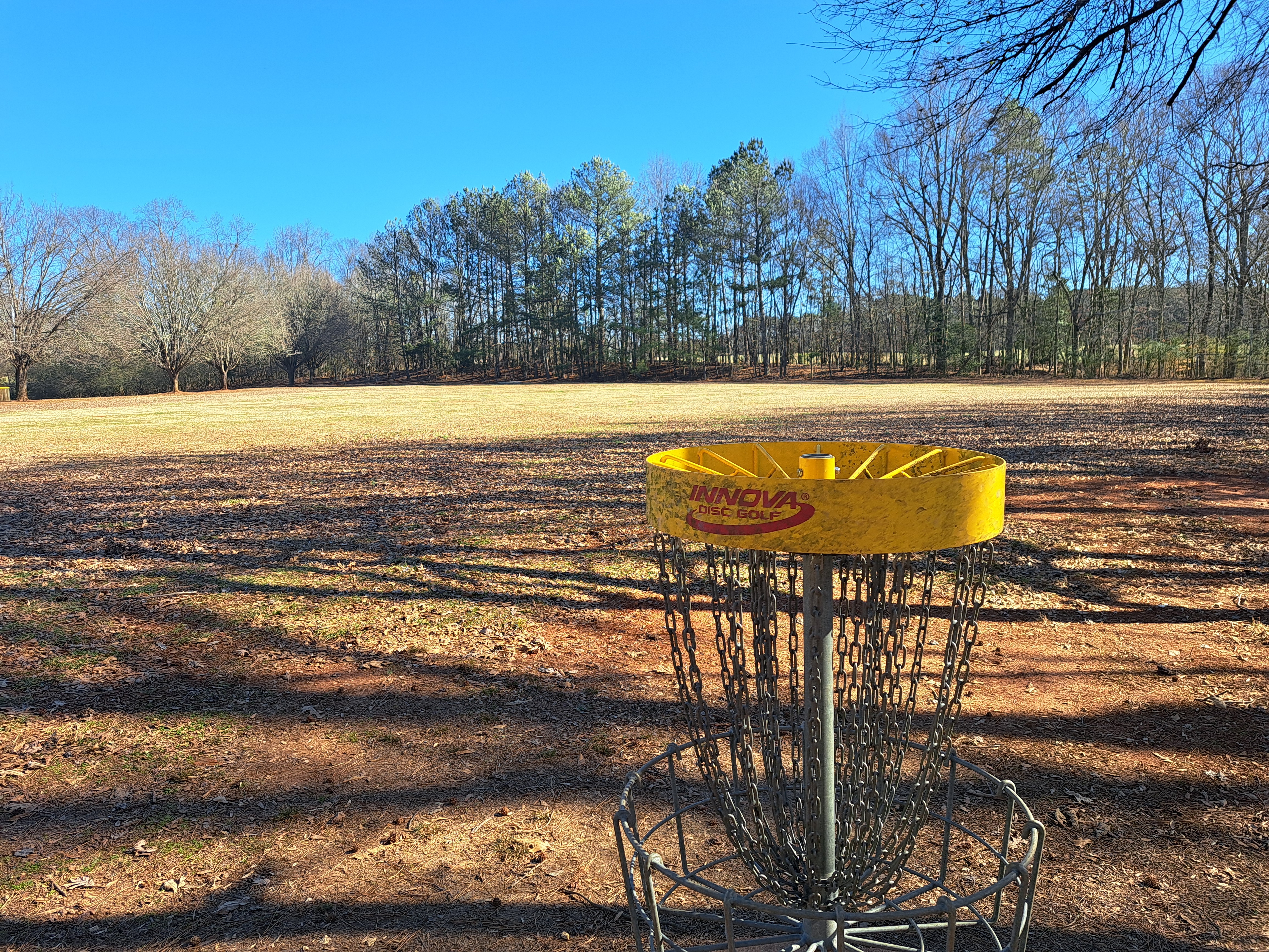
Baskets: yellow Discatcher, 1 per hole, in great shape on my visit
Signage: hole sign on each tee; arrows pointing to next tee on most holes
Amenities: practice basket, picnic shelters, athletic fields, playgrounds, concession building with soda machine between #15 basket and #16 tee
Summary Review: 3 Stars (out of 5)
Known locally as "The Sammy," the disc golf course at Sammy Haggard Park plays over rolling terrain among the park's other amenities. About half of the holes play in a heavily wooded area, while the other half are fairly open. The lines are pretty forgiving even on the heavily wooded holes, and this course is definitely designed for recreational play. Danielsville is located in the foothills of the north Georgia mountains, and this course has some elevation but no extreme elevation. The sand/gravel tees were heavily rutted on my visit, and they need to be upgraded to concrete or another more durable surface. The course route is unorthodox because of the park's ball fields and other amenities, and a couple of holes require significant walks from basket to next tee. I would have gotten lost were it not for the large number of arrow signs pointing to the next tee. With those arrows, I never had to reference the course map I had downloaded from dgcoursereview. Also, the course route does not form a loop: you have to walk across #6 fairway and 2 parking lots to get back to your car at the end of your round. These factors detract from the course, but they are necessitated by the land the designers had to work with. A gravel walking trail goes through the wooded areas. The trail comes into play on several holes, but it did not seem to be heavily used: I saw no other people on the course when I came here on a chilly Thursday afternoon in mid-January. Overall, this course is a solid course for recreational play, and local disc golfers should be thrilled that Madison County's only course is as good as it is. Skilled and experienced players will have a pleasant and relaxing round here but no more.
Hole-by-Hole Review
Distances taken from hole signs. Picture sequence for each hole is 1) tee, 2) approach, 3) basket to tee.
Hole #1: 345 feet, par 3


Comments: a sweeping dogleg right with a wide fairway. A couple of large trees guard the inside of the dogleg, but nothing really stops you from trying to cut the dogleg and play this hole as a straight hole. With a big enough arm, birdie is a real possibility on this hole. #2 tee is near the ballfield to the right.
Hole #2: 265 feet, par 3


Comments: this hole starts in a very open area, but 2 trees guard the basket, one on either side. The gap between the trees is reasonably wide, so an accurate throw should lead to a birdie opportunity. #3 tee is behind the basket.
Hole #3: 310 feet, par 3


Comments: completely flat, completely open, and completely boring as long as you don't miss long and throw your disc into the woods. #4 tee is to the right near the edge of the woods.
Hole #4: 255 feet, par 3


Comments: now the course heads into the woods where it will stay for the next 8 holes. This hole plays slightly downhill, and while you have at least 3 possible lines to choose from, all of them are tight. This is the first really good and challenging hole on this course. Signs warn of copperheads, and while you could definitely find copperheads in these woods, I did not see any. #5 tee is to the left.
Hole #5: 175 feet, par 3


Comments: another short and heavily wooded hole, this hole plays across a shallow but steep ravine. The line is tight but not super tight. Also, the gravel walking trail makes its first appearance both in front of the tee and behind the basket, so check for pedestrians before you throw. #6 tee is uphill to the right.
Hole #6: 210 feet, par 3


Comments: a moderately downhill hole where the fairway more or less coincides with the walking trail. The fairway is wide, but a single tree stands in front of the basket. A right-to-left disc flight gives you the most space to get around that tree. #7 tee is around the ravine to the right.
Hole #7: 175 feet, par 3


Comments: a flat, gradual dogleg left with a well-defined fairway that is plenty wide. This hole is very aceable with a good throw. #8 tee is to the left.
Hole #8: 250 feet, par 3


Comments: this hole plays across a shallow ravine...and across the gravel walking trail twice. There are several trees between the tee and basket, and the gaps between the trees are tight but exploitable with a good throw. The uphill near the basket is very steep, so make sure you throw it hard enough to get to the basket. #9 tee is to the left.
Hole #9: 290 feet, par 3


Comments: a gradual downhill dogleg right that plays across the gravel walking trail 2 more times. You can't see the basket from the tee, so this is a rather exciting throw. A small stream sits just beyond the basket, so take the hill into account and don't miss long. #10 tee is down the walking trail to the right.
Hole #10: 300 feet, par 3


Comments: another downhill hole, but this hole is straighter than the previous hole. It is also tighter with a large tree directly between the tee and basket. You could go around that tree on either side; going right is shorter but going left gives more room. Holes #8 through #11 is my favorite stretch of holes on this course. #11 tee is to the right.
Hole #11: 160 feet, par 3


Comments: a short but very steeply uphill hole. There is also a single tree directly between the tee and basket. More room exists to the right of that tree than to the left. In spite of the challenge, this hole is short enough that an accurate throw will likely lead to a birdie opportunity. This hole is frustrating if you hit a tree or your disc rolls back down the hill, possibly all the way behind the tee, but it is a fair challenge. #12 tee is to the right.
Hole #12: 375 feet, par 4


Comments: now we break back out into the open for the next 5 holes. This hole plays across a paved road that is open to vehicles, so have a spotter check for traffic before you throw. There are a few small trees scattered around the basket, but overall it is very open, open enough that maybe it should be a par 3. A slight right-to-left disc flight should set up a birdie or even an eagle opportunity. #13 tee is uphill to the left.
Hole #13: 400 feet, par 4


Comments: you can't see the basket from the tee, but you want to aim between the two trees to the left of the fenced-in ballfield and use a slight left-to-right disc flight. This slightly uphill hole is a gradual dogleg right with the fenced-in ballfield guarding the inside of the dogleg. Other than the few trees and ballfield, this hole is completely open, and therefore birdie should be very doable here. #14 tee is to the right around the soccer field.
Hole #14: 330 feet, par 3


Comments: another steeply uphill hole similar to hole #11 but longer and with a wider fairway. The pine trees on either side of the fairway are close enough and dense enough that they cause a real problem for an errant throw. #15 tee is behind the basket and across the gravel parking lot.
Hole #15: 410 feet, par 4


Comments: similar to the previous hole but steeply downhill instead of steeply uphill. In fact, holes #14 and #15 play about the same length once you factor in the hill; they should probably both be par 3's. A parking lot sits just beyond the basket, so try not to miss long. #16 tee is several hundred feet away near the playground; walk across the parking lot behind the basket, turn right to walk around the concession building, then turn left to walk beside the soccer field.
Hole #16: 360 feet, par 3


Comments: the last fairly open hole, a couple of large trees guard the right side of the fairway, so a left-to-right disc flight gives you the most room for error. The basket sits in the edge of the woods, and there is a steep drop-off just behind the basket. Don't miss long! #17 tee is up the wooden stairs to the right and then down the walking trail.
Hole #17: 230 feet, par 3


Comments: now back in the woods to stay, this gradual dogleg left plays slightly uphill. Although there are lots of trees, the fairway is rather wide, so a well-executed right-to-left throw will setup a birdie opportunity. #18 tee is back toward the tee and to the right.
Hole #18: 185 feet, par 3


Comments: a straight hole with a narrow fairway wedged between a steep hill on the left and some large trees on the right. This hole is very aceable with a slight left-to-right throw. Honestly, this hole is kind of an afterthought to close a pleasant not-too-difficult course. The parking lot is several hundred feet away; walk #6 fairway uphill in the reverse direction, then angle left and walk across 2 parking lots.
No comments:
Post a Comment